Set sail to discover all the amazing landscapes and places that Sardinia is waiting to offer you !
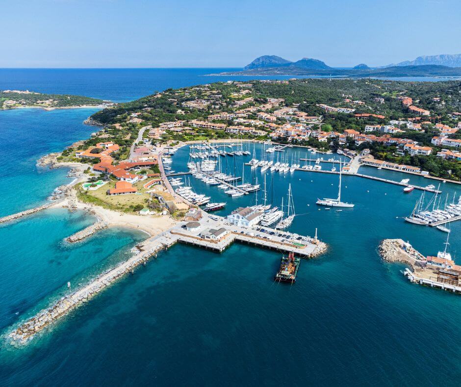
⚓ To get off to a good start, we recommend you to follow our Sardinia map. Begin your trip in the afternoon from IGY Portisco Marina, only 20 minutes from Olbia Costa Smeralda Airport. Portisco is a city situated in the north-east of the island, with an easy access to begin your 14-day route.
To follow our Sardinia map and to explore the different places that the Mediterranean coast offers, we recommend renting a sailboat. The Mediterranean Sea remains to be calm to sail along the Riviera. So sailboats are a good choice in order to discover in the best conditions with all the comfort you need!
You will find sunny terraces and restaurants along the port, with correct prices. Such as “La Dolce Vita – Marina di Portisco”, with Italian specialities or even “Ristorante Matt’s Portisco“, “Pizzeria e Steakhouse“.
⛵ Are you ready to live a ‘dolce vita’ holiday for two weeks?⛵
Day 1 : Sardinia’s map: from Portisco to Tavolara (10NM/1h)
🏁 Start your journey towards the beautiful island of Tavolara, only about 1h20min of navigation.
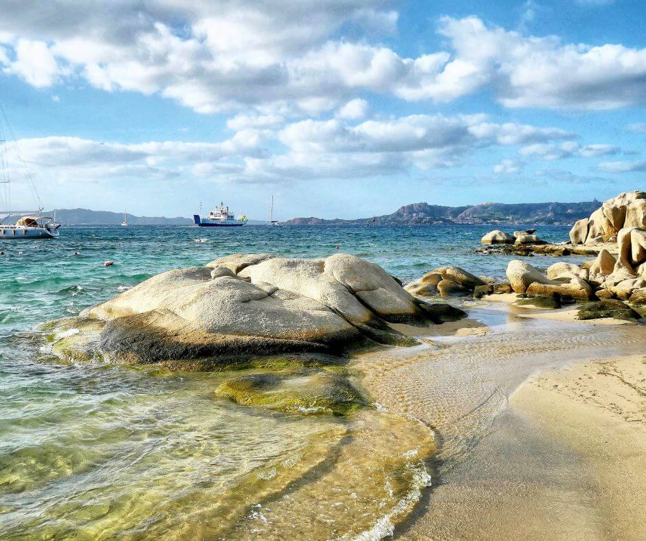
This wild island offers uncontaminated seabeds and it’s part of the Marine Protected Area of Tavolara and Capo Coda Cavallo. This place is ideal to swim in the midst of hundreds of fish in waters of a thousand shades of blue. It also has a unique fauna, characterized by the nesting of numerous species of seabirds.
Therefore, know that an important national film festival, “una notte in Italia” takes place in Tavolara during the summer.
💡 Other important information, keep in mind that the island is divided in two, with one part authorized for tourists. Sailing in Tavolara concerns the presence of a NATO base to the east, where disembarking is strictly prohibited.
In addition, the mountain and the Mediterranean maquis of the island cannot be explored without the consent of the family that owns the “Marzano” island. Accessing it without the consent of the owners is considered as a crime (private property violation).
Day 2 : Sardinia’s map: from Tavolara to Capo Coda Cavallo (6NM/1h20m)
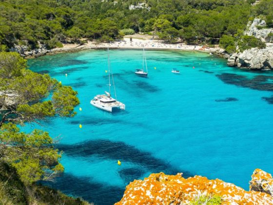
🏊 Once you’ve finished visiting Tavalora, at less than 1h of navigation, head to Capo Coda Cavallo. Here we advice you to definitely stop in the bay of Cala Brandinchi. Enjoy swimming in one of the most beautiful coves of Sardinia!
On the other hand, we recommend you to stop at the pools of Molara. A stretch of sea between the island and the coast where the transparency of the water and its turquoise colour will take your breath away!
Day 3 : Sardinia’s map: from Capo Coda Cavallo to Golfo Aranci (11NM/1h57m)
Between day 2 and 3, move north and reach Golfo Aranci. It is a splendid and well-known locality, at the north-eastern end of Sardinia. Extending over a land facing the sea and overlooking the Gulf of Olbia. Isn’t that nice?
In recent years it had a great tourist development thanks to its position in between Costa Smeralda to the north and the marine area of Tavolara to the south.
🏘️ Tavolara is a nice marina, don’t wait to visit the village. Characterized by colourful houses, it boasts its traditional cuisine with fish-based specialities. It also propses a long promenade that runs along the sea.
In the area, not only there are over twenty beaches, but also some of them are wild and others well-equipped for the most demanding customers. Around Capo Figari, there are the small beaches of fine golden sand of Cala Moresca.
You could sail to the protected reserve of Cala Greca, a pink pebble beach hidden by cliffs. Or, relax in the delightful Cala del Sonno, where fishermen took refuge. And last but not least, don’t hesitate to sail around Cala Sabina, reminding Caribbean traits.
Day 4 : Sardinia’s map: from Golfo Aranci to Porto Rotondo (6,75NM/1h30m)
🍷 After sailing and mooring around these unique beaches, we advise you to sail in to this famous village, known for its local food and wine products, Porto Rotondo.
Although, it is one of the most important tourist resorts in Sardinia and probably throughout Europe. The locality owes its name to a natural inlet of the Costa Smeralda. It has a circular shape that almost describes a perfect circle, giving rise to the homonymous name.
😎 This settlement represents one of the most popular social realities in the world, every year many boats of all kinds pour into its villas and moorings in its port. From motorboats to gigantic yachts hosting VIPs and celebrities from all over Europe. This destination offers some of the most famous nightclubs in all of Italy (ex. Blue Beach, Country Club).
Day 5 : Sardinia’s map: from Porto Rotondo to Mortorio (3,71NM/53m)
Very close to Porto Rotondo, at about 40 minutes sailing, find the beautiful island of Mortorio, precisely located in the south-east of the Maddalena Archipelago. The entire area has been officially defined as part of the La Maddalena Archipelago National Park, with full ownership rights.
Consequently, it is a protected area subject to environmental protection regulations.
Although, the island is a very famous touristic destination, especially for the ones who are used to sail in North Sardinia.
People usually decide to moor in Cala Mortorio, a protected cove. Which permits you to relax and to immerse yourself with a backdrop of natural wonders, far from commercial tourist contamination.
Day 6 : Sardinia’s map: from Mortorio to Porto Cervo (5,75NM/1h20m)
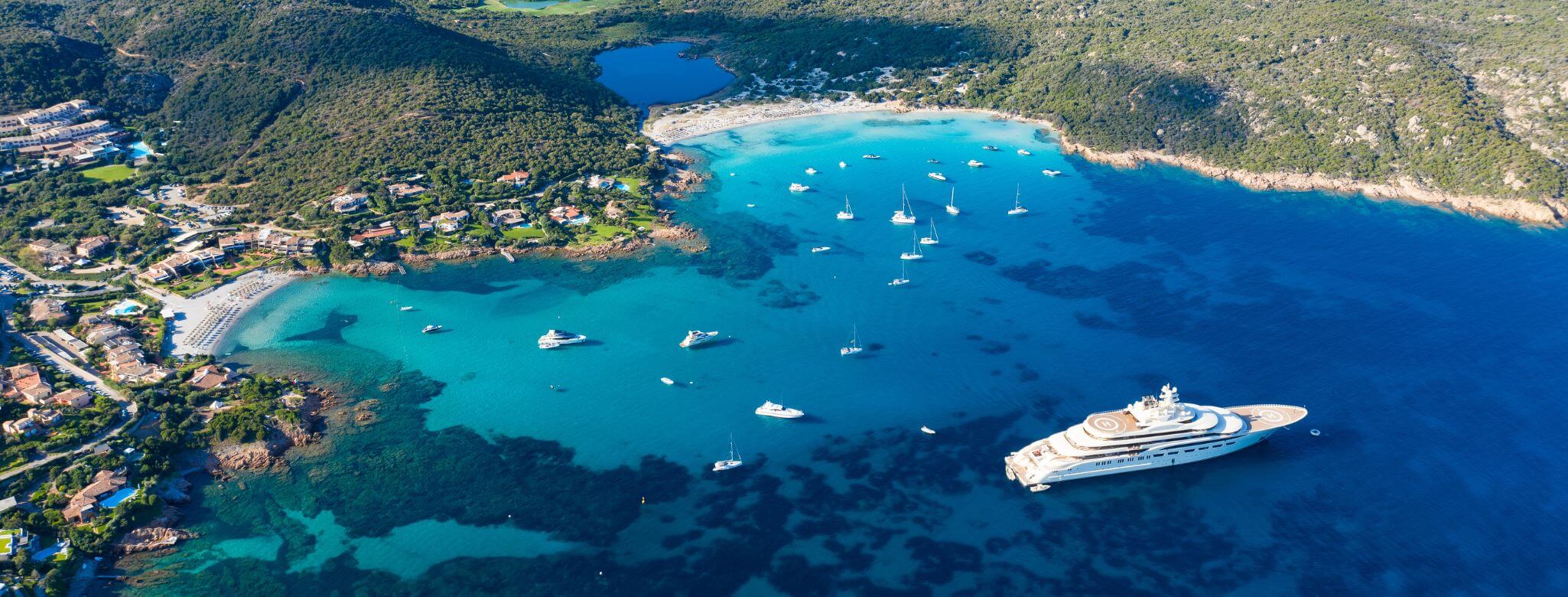
After reconnecting with nature, let’s change the sailing background, next stop is… Porto Cervo. Situated in the heart of Costa Smeralda, this seaside resort is probably the most famous village of the area. The town was born on a natural harbour that is said to be in the shape of a deer. From which the name of the homonymous city certainly comes. The landscape and natural resources that arise around the settlement are of spectacular beauty. Especially, they are one of the major strengths of the area.
Porto Cervo has one of the most modern and famous marinas in all of Italy, capable of hosting around seven hundred boats. It’s a luxury and prestigious destination, which every year is visited by many famous personalities. For all these reasons, spots in marina can be quite expensive. So if you have a limited budget, you can possibly plan to dock nearby and reach it with a transfer.
Day 7 : Sardinia’s map: from Porto Cervo to Caprera (6,47NM/1h30m)
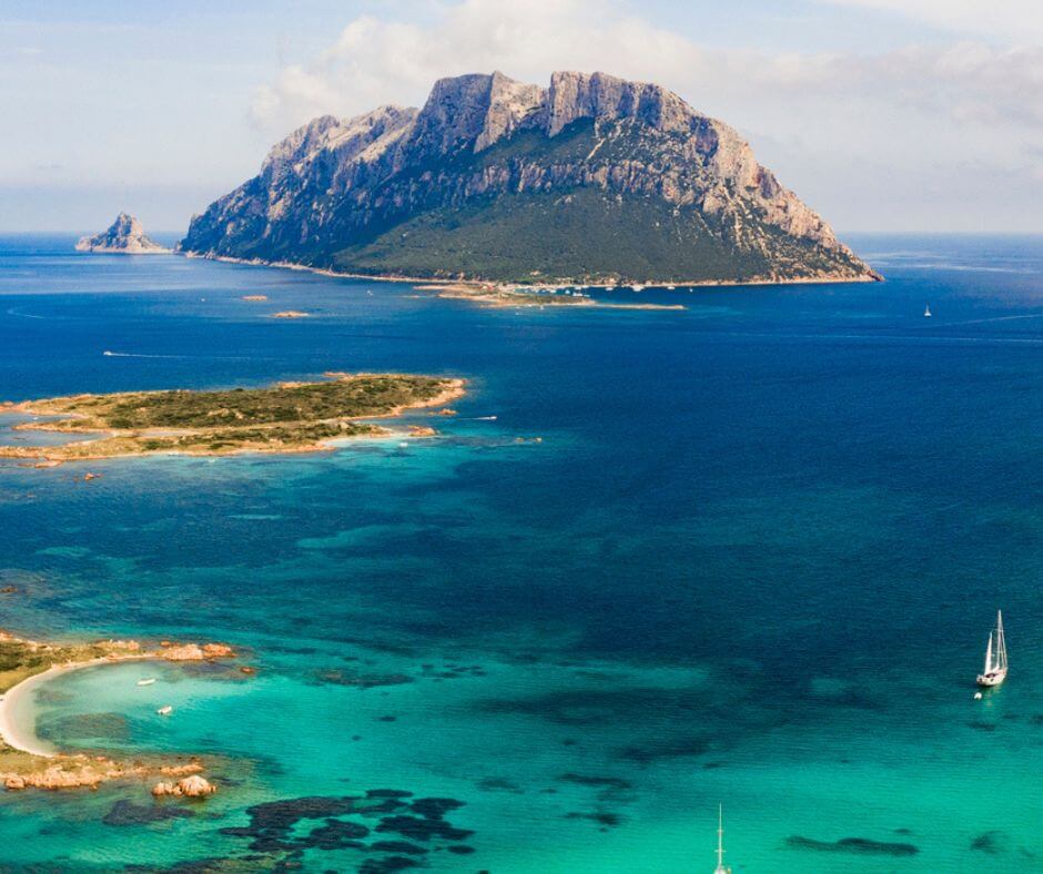
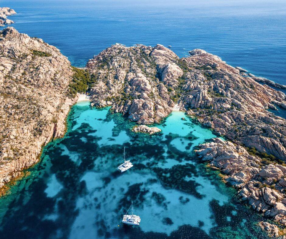
🏝️ At less than 1h sailing from Porto Cervo you will find the island of Caprera, the second most known island of the archipelago of Maddalena. Caprera occupies the south-eastern space of the archipelago and shows its largest surface to the queen island, namely La Maddalena.
Visiting Caprera by boat allows you to visit all the most popular beaches and coves, including Cala Andreani, Relitto beach and Cala Coticcio. It is important to remember that Caprera is part of the natural park of La Maddalena. It’s a nationally protected marine and terrestrial area in which you will need a permission to sail (you can easily ask the boat owner when booking the boat).
Day 8 : Sardinia’s map: from Caprera to La Maddalena (5,60NM)
Then, point your way towards La Maddalena, which is the largest of the islands of the homonymous archipelago. Among other things it is the only one, together with Caprera, to be inhabited. In the archipelago, we can find Santo Stefano, Budelli, Razzoli, Spargi and Santa Maria. These islands can be all well visited by boat. As mentioned, due to the beauty of its territory and its waters, the archipelago of La Maddalena has been declared a protected National Park.
🍕 For the lunch break, you can decide to go on the mainland or stay on the boat. If you decide to go ashore, La Mula‘s is highly recommended for great take-away pizza.
Some of its numerous beaches have been declared among the most beautiful and evocative in the world.
Such as: the Rosa beach, Cala Napoletana, the Cavaliere beach on the island of Budelli, Cala Napoletana and Cala Corsara, all of these deserve a visit.
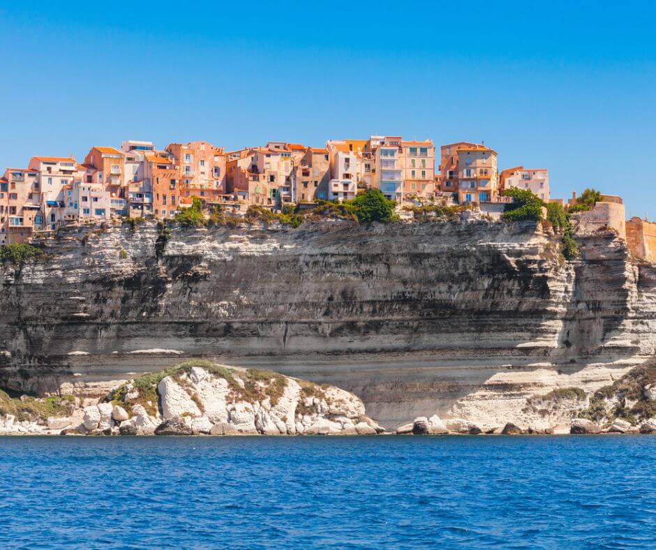
Day 9 : Sardinia’s map: from La Maddalena to Bonifacio (16NM/2h28m)
🗺️ After some short navigations in the Maddalena archipelago, you can set sail for a more adventurous route and head to Corsica!
make sure before leaving to check the weather and the level of wind, since the navigation area between Sardinia and Corsica is characterized by high pressure and winds. Especially the area of the famous “Bocche di Bonifacio”.
🥽 Bonifacio offers a wide choice of beaches, particularly ideal for sand lovers, for example Rondinara, Tonnara, Maora, Balistra, and Piantarella. Moreover, for sailors and sportspeople, Bonifacio is an ideal city. Characterized by windy days almost 80% of the year, sailing sports and scuba diving are the two main activities.
Finally, Bonifacio is also the flagship for enjoying the different coves of the coasts of Corsica. Both by land and by sea, you can reach these little corners of paradise. They are a real mix of hidden and unusual places to create special memories such as: Sperone, 3 Punti beach, Paragan, Canetu, Fazziò.
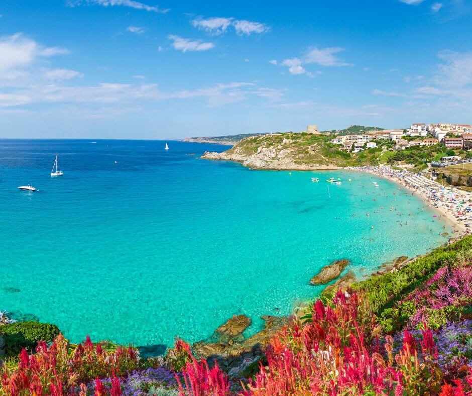
Day 10 : Sardinia’s map: from Bonifacio to Santa Teresa Di Gallura (9,3NM/1h32m)
After a day and a night in Corsica, on the way back, you can definitely stop to Santa Teresa di Gallura, another of the most popular maritime locations in Sardinia. Its marina is one of the most important of the Gallura region and covers a strategic touristic role because of its proximity with Corsica.
However, the surrounding coast provides many beautiful bays, beaches, and coves, some of them are only reachable by boat. The sandy beach of Rena Bianca is well protected from the wind on both sides. It’s located close from the town centre. We recommend you also to visit Rena di Ponente and Rena di Levante. These 2 beaches allow you to enjoy the sea with any wind condition, because they are divided by a stripe of land
Day 11 : Sardinia’s map: from Santa Teresa Di Gallura to Spargi – Palau (11,9NM/1h7m)
Futhermore, once you finished sailing in the extreme north-western part of the itinerary, it’s time to start going back east towards Portisco. You can stop again in Spargi island, where in the south you will find again the beautiful Cala Corsara. It’s an isalnd well protected from the wind. Later sail towards Palau, where you will also find an equipped marina.
🏖️ Accordingly, the area of Palau also provides some beautiful beaches: Spiaggia di Punta Nera, Spiaggia di Nelson, Cala Martinella (better in the morning because of high traffic). Also, Spiaggia di Cala di Trana, Spiaggia delle dune di Porto Pollo (3 km long and perfect by boat to avoid crowds).
Day 12 : Sardinia’s map: from Spargi – Palau to Baja Sardinia (5,6nm)
After some daytime swims, sail towards Baja Sardinia to enjoy some nice Sardinian nightlife. The area of Baja Sardinia hosts some of the best clubs in Costa Smeralda. Among these. We definitely recommend you to enjoy a good apéritif with some nice music in the famous “Phi Beach”.
🎶 In fact, it’s a very suggestive open-air location by the sea (also accessible by boat). famous international DJs used to play almost every day. We higly recommendate night dancers to go gave fun at Ritual Club. It’s an iconic nightclub of the area entirely built in the stone.
Day 13 : Sardinia’s map: from Baja Sardinia back to Portisco (13,9NM/27m)
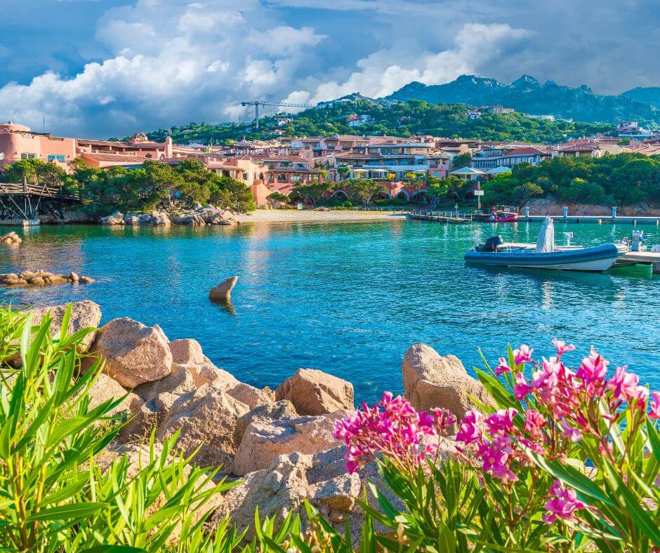
🌅 Finally, after a night in Baja Sardinia, wake up in the late morning and sail back to Portisco after a good breakfast on the boat and perhaps a morning swim. The sea of Portisco was declared blue flag of Europe for the beauty of the sea and the pristine seabed.
Then for your last day, enjoy the landscapes by boat, while you sail gently back to Portisco.
Well, every good thing comes to an end! We were thankful to have you on board and to guide you through your journey with our Sardinia map. We hope you had a fabulous experience aboard of your boat and that you enjoyed sailing through Sardinia. Don’t forget to leave the boat clean and in the same conditions that you found it. 😄