Share the post "Essential Marine Navigation Tools and Techniques"
Embarking on a maritime adventure is a thrilling endeavour that requires the right navigation tools and techniques to explore vast and unpredictable oceans. Whether a seasoned sailor or a novice explorer, the key to a successful voyage lies in your mastery of nautical navigation. This article will explore the essential navigation tools and techniques for boating. We will first explore the different navigation methods, both modern and traditional. Then, we will delve into the tools and apps used in the types of navigation. Therefore, the next time you embark on a sailing holiday with Click&Boat, you have all the information to guide you through uncharted waters and keep you on the right course!
Types of Nautical Navigation
Navigating the seas has always been a complex task, requiring sailors to employ various methods and tools to determine their position accurately. We will explore traditional methods such as dead reckoning and celestial and coastal navigation, as well as modern methods like radio and satellite navigation. Each method offers a unique approach and uses specific navigation tools to guide sailors’ journeys. These techniques ensure safe and efficient sailing trips.

Celestial Navigation
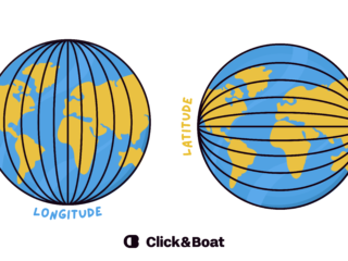
Celestial navigation involves determining your ship’s position using celestial bodies such as the sun, moon, stars, and planets. Sailors can calculate their latitude and longitude by measuring the angles between these celestial bodies and the horizon. Celestial navigation requires accurate timekeeping, sextants, and nautical almanacs containing celestial data.
Dead Reckoning
Dead reckoning is a technique used to estimate your boat’s current position by calculating its previous known position, the course steered, and the distance travelled. It involves continuously updating the position based on speed, course, and elapsed time. To estimate the new position, dead reckoning considers factors such as wind, currents, and tides.
Coastal Navigation
Coastal navigation involves navigating a vessel along the coastline, usually within sight of land. It relies on visual observations, landmarks, charts, and aids to navigation like lighthouses, buoys, and beacons.
Radio Navigation
Radio navigation involves using radio waves and signals to determine a ship’s position. Various radio navigation systems exist. For example, Very High-Frequency Omni-Directional Range (VOR) is a short-range radio system that provides directional information. Distance Measuring Equipment (DME) also works with VOR and calculates distance. Automatic Direction Finder (ADF) helps determine the relative bearing from a radio transmitting station.
Satellite Navigation
Satellite navigation, also known as Global Navigation Satellite Systems (GNSS), uses a constellation of satellites to provide positioning, navigation, and timing information. The most well-known GNSS is the Global Positioning System (GPS), but there are other systems such as GLONASS, Galileo, and BeiDou. Satellite navigation receivers calculate their positions based on signals received from multiple satellites.
Combining different navigation methods
In real life, good navigators mix several methods instead of relying on just one. You might use GPS as your primary source, then confirm it with a quick position fix on the chart or by lining up two landmarks on shore. Offshore, a simple dead reckoning plot helps you understand where currents and wind may be pushing you. Celestial navigation adds a valuable backup if electronics fail. Thinking in terms of “primary method plus cross-checks” makes your navigation more accurate and much safer.
Marine Navigation Tools
Navigation tools enable sailors to navigate the seas precisely and confidently. We will explore several essential instruments that have played a crucial role in maritime navigation throughout history and continue to do so in the modern era. Whether relying on time-tested methods or advanced technological systems, sailors rely on these navigation instruments to guide their course, avoid hazards, and reach their destinations safely. To learn more about boat safety, check out this blog!
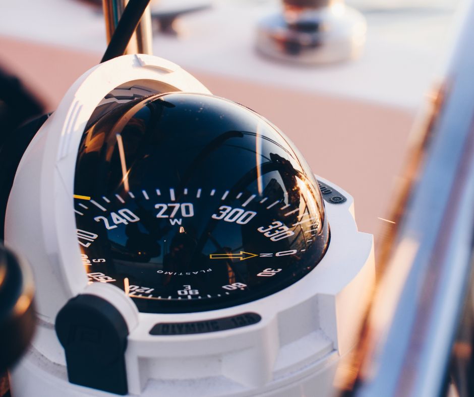
Compass
A reliable compass is an essential tool for any sailor. It provides a simple and effective means of determining your heading and ensuring you stay on course, especially when electronic systems may fail or lose accuracy.
Sextant
Although considered more of a backup tool in modern times, a sextant remains a valuable instrument for celestial navigation. By measuring the angle between a celestial body and the horizon, sailors can determine their latitude and longitude, providing an additional layer of navigational redundancy.
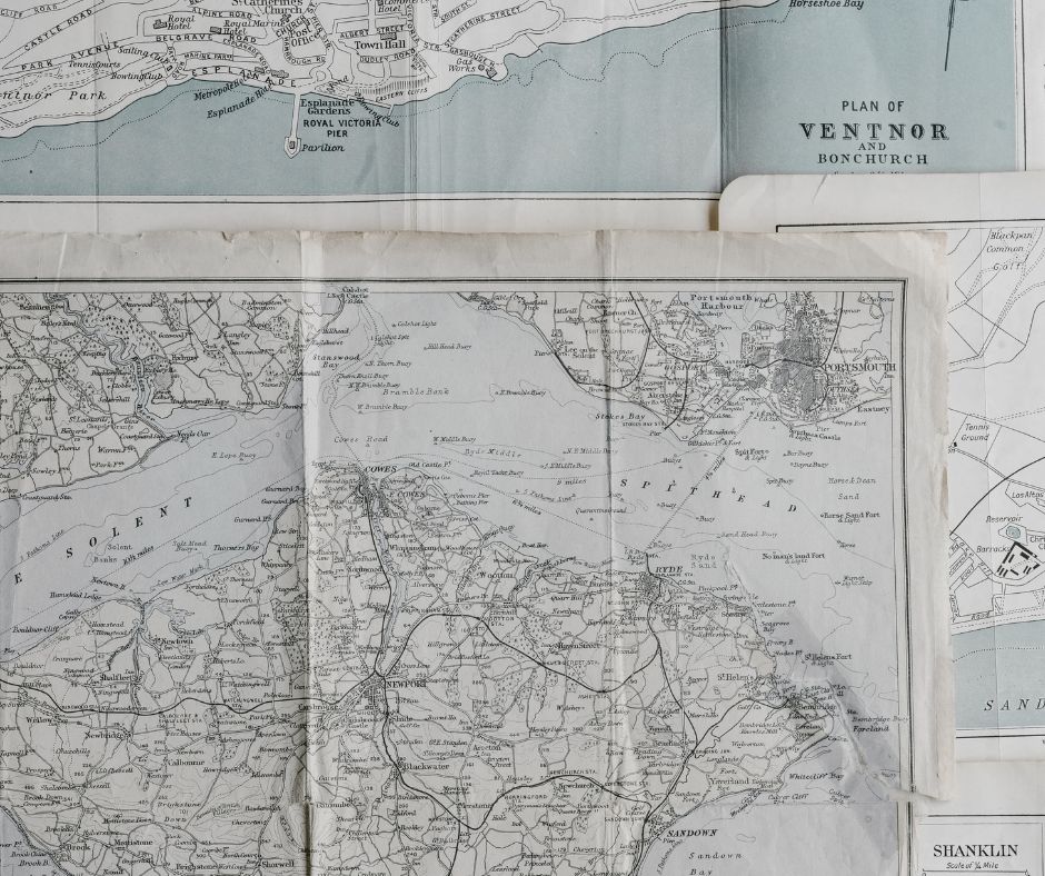
Nautical Charts
Nautical charts are maps specifically designed for navigation at sea. They provide detailed information about water depths, navigational aids, coastal features, hazards, and other crucial information for safe passage. Nautical charts are essential for planning and executing a voyage.
GPS
Global Positioning System (GPS) is a satellite-based navigation system that provides precise positioning and timing information anywhere on Earth. GPS receivers on board ships receive signals from multiple satellites, allowing them to accurately determine their latitude, longitude, and speed.
Radar
Radar (Radio Detection and Ranging) uses radio waves to detect and locate objects, including other ships, land masses, and navigational hazards. It provides information about these objects’ range, bearing, and relative motion. As a result, this aids collision avoidance and navigation.
Depth Sounder
Understanding the depth of the water beneath your vessel is crucial for avoiding shallow areas and potential grounding. Depth sounders use sonar technology to measure the distance from the water’s surface to the seabed, providing real-time depth readings to aid safe navigation.
Nautical Navigation Apps
Technological advancements have given sailors a wide array of navigation instruments and apps designed to enhance safety and efficiency on the water. Marine navigation apps have become a powerful tool in a sailor’s arsenal. Some of the best marine navigation apps available are the following.
Navionics
Navionics is popular among sailors due to its user-friendly interface and comprehensive navigation features. It offers detailed charts, real-time weather data, tidal information, and the ability to plan routes and track your journey. This app is available for both iOS and Android devices.
iNavX
iNavX is another highly-rated marine navigation app. It is the leading handheld chart plotter, trusted by sailors, fishermen, and cruisers worldwide, and provides charts from popular providers. It also offers advanced features like waypoint management, route planning, and integration with external instruments like AIS and radar. iNavX is compatible with iOS devices.
OpenCPN
OpenCPN is a free and open-source marine navigation software available on various platforms, including Windows, Mac, and Linux. It offers a wide range of chart options, route planning, GPS integration, and support for multiple plugins to enhance functionality.
Understanding and utilising both traditional and modern navigation tools and techniques is vital for sailors. Traditional techniques showcase the rich history and art of maritime navigation and provide backup options in case of technological failures. However, modern tools offer accuracy, convenience, and real-time information. It also enhances efficiency, safety, and navigational precision. By embracing a comprehensive approach to navigation, mariners can navigate the seas with confidence, resilience, and a deep appreciation for the evolving field of maritime navigation.
Tips for using navigation apps safely
Navigation apps are extremely useful, but they should support your seamanship, not replace it. Always download charts for offline use and keep your device charged, ideally with a backup power source on board. Check that your app uses official or regularly updated charts, not outdated imagery. Compare the app’s position with your GPS or chart plotter when possible. Most importantly, continue to look outside, read the water and use buoys, depth and landmarks to confirm what the screen shows.
FAQ
Yes. GPS is extremely reliable, but paper charts provide a wide overview and a backup if electronics or power fail.
A compass, paper charts, a depth sounder and a reliable GPS are a solid starting kit, supported by a simple logbook.
In coastal waters, many skippers check every 15-30 minutes, or more often in bad weather, strong current or heavy traffic.
They can be, if you keep them updated, use offline charts and carry backup power. However, they should not be your only tool.
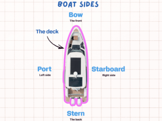
Heading is the direction the bow is pointing. Course (or track) is the actual path over the ground, which can differ because of wind and current.