Share the post "Latitude and Longitude: What is the difference?"
Latitude and longitude are the foundation of the geographic coordinate system used to locate any place on Earth. Whether you are reading a nautical chart, using a GPS, or planning a sailing route, these two measurements work together to pinpoint an exact position on the globe.
Although they are often mentioned together, they describe two very different things. Understanding the difference between them is essential for navigation, travel, and map reading, especially at sea.
What is latitude?
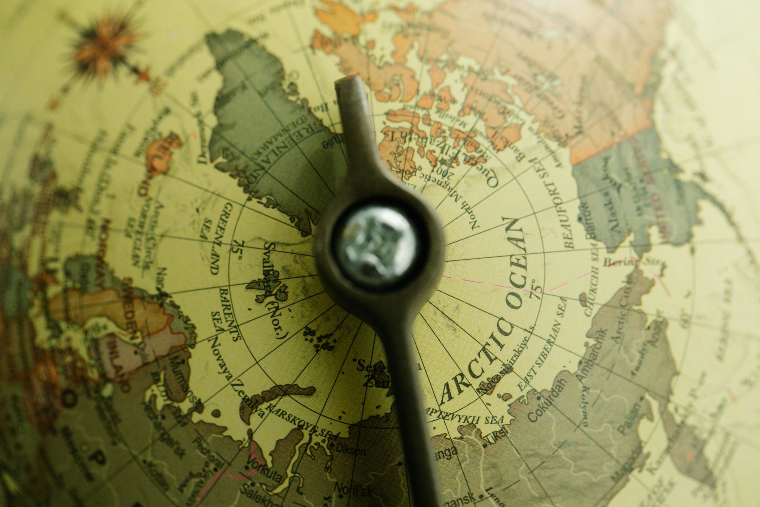
Latitude indicates how far north or south a location is from the Equator. The Equator is an imaginary line that circles the Earth horizontally and sits at 0 degrees latitude. From there, latitude values increase as you move toward the poles.
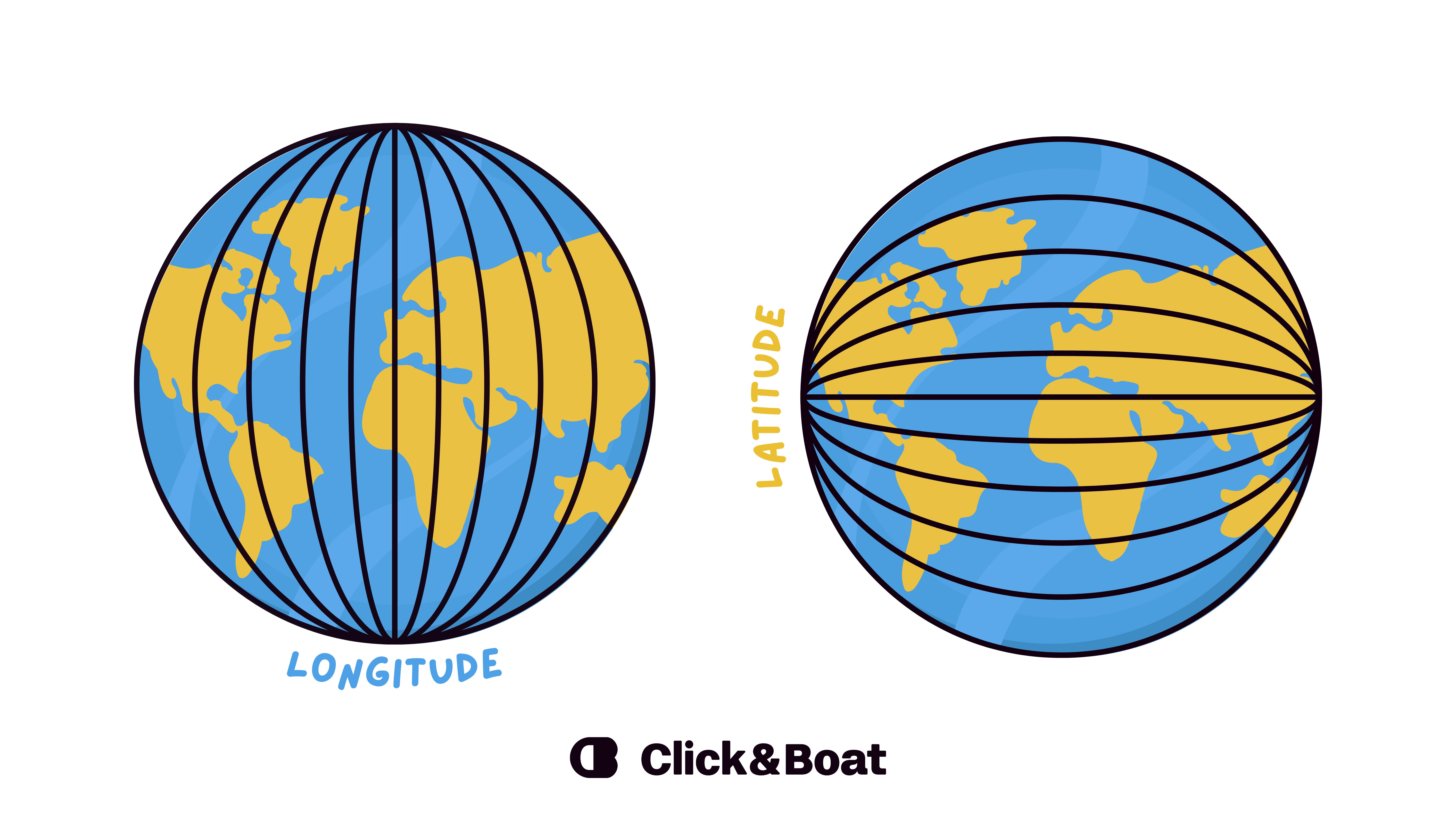
Lines of latitude run parallel to the Equator, which is why they are often called parallels. They never intersect each other and always remain evenly spaced. Latitude ranges from 0° at the Equator to 90° North at the North Pole and 90° South at the South Pole.
In practical terms, latitude plays an important role in climate and weather. Locations closer to the Equator generally experience warmer temperatures, while places at higher latitudes tend to have colder climates. For sailors and travelers, latitude helps indicate how far north or south a destination lies.
Did you know?
One minute of latitude equals one nautical mile (1 NM = 1,852 meters).
This is why latitude is especially important in marine navigation. Distances on nautical charts are directly linked to latitude, making route planning more intuitive for sailors.
What is longitude?
Longitude measures how far east or west a location is from the Prime Meridian. The Prime Meridian is another imaginary line, running vertically from the North Pole to the South Pole. It lies at 0 degrees longitude. It passes through Greenwich, in the United Kingdom.
Lines of longitude, also known as meridians, converge at the poles. Unlike latitude, longitude values range from 0° to 180° east or west. The meridian opposite the Prime Meridian is close to 180° and is associated with the International Date Line.
Longitude is closely linked to time zones and navigation. Knowing your longitude helps determine local time and is essential for accurate positioning at sea, especially when navigating long distances.
A historical challenge for sailors
Latitude has been relatively easy to calculate at sea for centuries using the sun and stars. Longitude, however, remained a major challenge until the 18th century, when accurate marine chronometers were developed. Solving the “longitude problem” revolutionized maritime navigation and made long-distance sea travel far safer.
The main difference between latitude and longitude
The key difference lies in what they measure and how they appear on the globe. Latitude describes a north–south position and runs horizontally, while longitude describes an east–west position and runs vertically.
Another important distinction is that latitude lines never meet, whereas longitude lines all intersect at the poles. Together, these two measurements create a grid that covers the entire Earth, making it possible to identify any location with precision.
How latitude and longitude work together?
To locate a place accurately, latitude and longitude must always be used together. Latitude alone only tells you how far north or south you are, and longitude alone only tells you how far east or west you are. When combined, they form a pair of coordinates that points to a single spot on the globe.
This coordinate system is used in maps, GPS devices, aviation, and maritime navigation. For boating and sailing in particular, latitude and longitude are essential for plotting routes, sharing positions, and ensuring safe navigation at sea.
Coordinates and modern GPS
Even with today’s advanced GPS technology, positioning still relies on geographic coordinates. Satellites calculate your location using latitude and longitude, the same global system that has been used for centuries.
Whether you are navigating with a chartplotter on board or checking your position on a smartphone, the underlying system remains the same : proof of how reliable and universal latitude and longitude truly are.
FAQ
What is latitude in simple terms?
Latitude is the distance of a place north or south of the Equator. It helps describe how high or low a location is on the globe.
What is longitude in simple terms?
Longitude is the distance of a place east or west of the Prime Meridian. It helps describe how far left or right a location is on the globe.
Can latitude and longitude exist without each other?
No. To identify an exact location on Earth, you need both latitude and longitude. One without the other is not precise enough.
Why are latitude and longitude important for navigation?
They allow sailors, pilots, and GPS systems to determine exact positions, calculate routes, and navigate safely across land and sea.
Which comes first: latitude or longitude?
By convention, latitude is usually written first, followed by longitude.